Trail Walking La Ferté-Alais - De la Ferté Alais à Boutigny sur Essonne - Photo

De la Ferté Alais à Boutigny sur Essonne

 tracegps
tracegps

User

© OpenStreetMap contributors
Length
Length
25 km
Max alt
Max alt
139 m
Uphill gradient
Uphill gradient
328 m
Km-Effort
Km-Effort  
29 km
Min alt
Min alt
52 m
Downhill gradient
Downhill gradient
329 m
Boucle
Boucle
Yes
Creation date :
2014-12-10 00:00:00.0
Updated on :
2014-12-10 00:00:00.0

(0 Reviews)

Walking
Walking
5h00
Difficulty : Difficult

Scan this QR Code to open this trail in the SityTrail application

FREE GPS app for hiking

Logo SityTrail SityTrail

IGN / Geographical institutes

Download SityTrail from the App Store Download SityTrail from Google Play

Logo SityTrail SityTrail World

The world is yours!

Download SityTrail from the App Store Download SityTrail from Google Play Download SityTrail on Huawei AppGallery

About

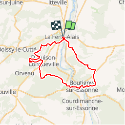
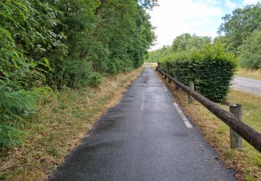
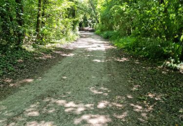
Trail Walking of 25 km to be discovered at Ile-de-France, Essonne, La Ferté-Alais. This trail is proposed by tracegps.

Description

Circuit proposé par le Comité Départemental de Randonnée des Hauts de Seine. Parking départ : la Ferté-Alais centre. Descriptif : PR, la Ferté Alais; Guigneville-sur-Essonne, bois de Guigneville, Marchais, ....nb, la Pièce de Marchais ....GR1, Boutigny-sur-Essonne, Vayres-sur-Essonne, Rocher de Beurre, D'Huison-Longueville, GR111a ...GR111a, Butte Hebert, Cerny, la Ferté-Alais. Des sentiers ont pu être modifiés depuis la dernière validation et les itinéraires proposés n’engagent pas la responsabilité du Comité. Signalez-nous les modifications rencontrées pour mise à jour de la randothèque.

Elevation profile

Photos

Positioning

Country:
France
Region :
Ile-de-France
Department/Province :
Essonne
Municipality :
La Ferté-Alais
Location:
Unknown
Start:(UTM)
451952 ; 5370137 (31U) N.

Trails nearby

Trail Walking Itteville - Les vieilles ailes - Photo
Walking
c.chehere

Walking

Easy
(1)
Itteville, Ile-de-France, Essonne, France
16.8 km | 19.2 km-effort
3h 37min
Yes
Trail Mountain bike Lardy - Autour de Lardy en VTT - Photo
Mountain bike
tracegps

Mountain bike

Medium
(1)
Lardy, Ile-de-France, Essonne, France
31 km | 38 km-effort
2h 4min
Yes
Trail On foot Itteville - Chemin des Marais - Photo
On foot
PRO

On foot

Easy
Itteville, Ile-de-France, Essonne, France
14.3 km | 16 km-effort
3h 38min
No
Trail Mountain bike Baulne - Les Marais de l'Essonne 29,5 km - Photo
Mountain bike
Bastet

Mountain bike

Easy
(1)
Baulne, Ile-de-France, Essonne, France
30 km | 33 km-effort
2h 12min
Yes
Trail Walking La Ferté-Alais - la ferté alais la sablière - Photo
Walking
mdsaintjalmes

Walking

Medium
(2)
La Ferté-Alais, Ile-de-France, Essonne, France
12.5 km | 14.8 km-effort
3h 15min
Yes
Trail Walking Mondeville - Boucle mondeville par videlles - Photo
Walking
Glurps

Walking

Very easy
(1)
Mondeville, Ile-de-France, Essonne, France
16.1 km | 18.6 km-effort
4h 2min
Yes
Trail Walking Ballancourt-sur-Essonne - V2foretxhospitalierexdexlaxcoudrayexballancourt-sur-essonne - Photo
Walking
philippevh

Walking

Medium
(1)
Ballancourt-sur-Essonne, Ile-de-France, Essonne, France
6.1 km | 7.9 km-effort
1h 47min
Yes
Trail Walking Bouville - Bouville - Photo
Walking
guydu41

Walking

Medium
Bouville, Ile-de-France, Essonne, France
8.4 km | 10.3 km-effort
2h 20min
Yes
Trail Walking Boutigny-sur-Essonne - Boutigny-sur-Essonne  - Photo
Walking
guydu41

Walking

Medium
Boutigny-sur-Essonne, Ile-de-France, Essonne, France
6.4 km | 8.5 km-effort
1h 56min
Yes


Close
My subscriptions